
Tập tin:Peru - Location Map (2011) - PER - UNOCHA.svg

| Tập tin này từ Wikimedia Commons. Trang miêu tả nó ở đấy được sao chép dưới đây. Commons là kho lưu trữ tập tin phương tiện có giấy phép tự do. Bạn có thể tham gia. |
_-_PER_-_UNOCHA.svg?uselang=vi)
Miêu tả
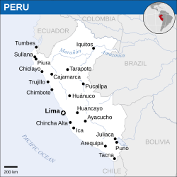
| Miêu tả | English: Locator map of Peru. |
| Ngày | |
| Nguồn gốc | English: Peru Locator Map (ReliefWeb) |
| Tác giả | |
| SVG genesis |
Giấy phép
- Bạn được phép:
- chia sẻ – sao chép, phân phối và chuyển giao tác phẩm
- pha trộn – để chuyển thể tác phẩm
- Theo các điều kiện sau:
- ghi công – Bạn phải ghi lại tác giả và nguồn, liên kết đến giấy phép, và các thay đổi đã được thực hiện, nếu có. Bạn có thể làm các điều trên bằng bất kỳ cách hợp lý nào, miễn sao không ám chỉ rằng người cho giấy phép ủng hộ bạn hay việc sử dụng của bạn.
 This map is part of a collection of 216 free country maps, created by the UN Office for the Coordination of Humanitarian Affairs (OCHA), to be used in print, web or broadcast products. The ReliefWeb Location Maps released here are maps that highlight a country, its capital, major populated places and the surrounding regions. Attribution Requirements Using the map without modifications: ensure that the sources and the disclaimer are below the map. Credit as follows: "Credit: OCHA". For use with alteration: remove the OCHA logo and disclaimer following any modification to the map, but keep the data sources as mentioned below the map. Credit the modified map as follows: "Based on OCHA map". You are responsible for the content of your map. We are keen to receive your feedback and hear how you used OCHA's maps. We would be grateful if you would notify us by e-mail and share your work with us. UN Disclaimer The designations employed and the presentation of material of this map do not imply the expression of any opinion whatsoever on the part of the Secretariat of the United Nations concerning the legal status of any country, territory, city or area or of its authorities or concerning the delimitation of its frontiers or boundaries. |
Lịch sử tập tin
Nhấn vào ngày/giờ để xem nội dung tập tin tại thời điểm đó.
| Ngày/giờ | Hình xem trước | Kích cỡ | Thành viên | Miêu tả | |
|---|---|---|---|---|---|
| hiện tại | 13:54, ngày 7 tháng 9 năm 2016 | | 250×250 (362 kB) | Wereldburger758 | Resized page to drawing. Removal watermark. Validation of image. |
| 00:47, ngày 8 tháng 5 năm 2014 |  | 254×254 (389 kB) | UN OCHA maps bot | == {{int:filedesc}} == {{Information |description={{en|1=Locator map of Peru.}} |date=2011 |source={{en|1=[http://reliefweb.int/map/peru/peru-location-map-2011 Peru Locator Map (ReliefWeb)]}} |author={{en|1=[[w:en:United Nations Office fo... |
Trang sử dụng tập tin
Sử dụng tập tin toàn cục
Những wiki sau đang sử dụng tập tin này:
- Trang sử dụng tại es.wikipedia.org
- Trang sử dụng tại id.wikipedia.org
- Trang sử dụng tại ms.wikipedia.org
- Trang sử dụng tại sd.wikipedia.org
_-_PER_-_UNOCHA.svg)