Tập tin:Bangladesh - Location Map (2013) - BGD - UNOCHA.svg

| Tập tin này từ Wikimedia Commons. Trang miêu tả nó ở đấy được sao chép dưới đây. Commons là kho lưu trữ tập tin phương tiện có giấy phép tự do. Bạn có thể tham gia. |
Miêu tả
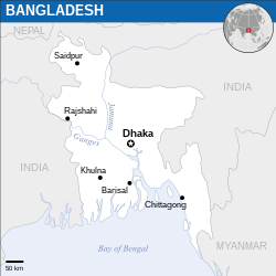
| Miêu tả | Català: Mapa de localització de Bangladesh. English: Locator map of Bangladesh. |
| Ngày | |
| Nguồn gốc | English: Bangladesh Locator Map (ReliefWeb), ESRI, UNCS, Natural Earth |
| Tác giả | |
| Phiên bản khác |
|
| SVG genesis |
_-_BGD_-_UNOCHA.svg&lang=ca)
_-_BGD_-_UNOCHA.svg&lang=en)
_-_BGD_-_UNOCHA.svg?uselang=vi)
Tập tin SVG này chứa văn bản nhúng có thể biên dịch sang ngôn ngữ của bạn, bằng cách dùng một trình chỉnh sửa hỗ trợ SVG (như XML hay văn bản). Để biết thêm thông tin, xem Về việc biên dịch tập tin SVG. |
Tập tin đã được biên dịch này dùng thành phần SVG Để nhúng tập tin này bằng ngôn ngữ của bạn (nếu có sẵn), hãy dùng tham số Để dịch tập tin này sang ngôn ngữ của bạn, hãy tải nó về máy tính, thêm bản dịch của bạn và tải nó lên lại với cùng tên. Bạn có thể tìm thấy sự giúp đỡ tại Phòng thí nghiệm đồ họa nếu không chắc phải làm thế nào. |
Giấy phép
- Bạn được phép:
- chia sẻ – sao chép, phân phối và chuyển giao tác phẩm
- pha trộn – để chuyển thể tác phẩm
- Theo các điều kiện sau:
- ghi công – Bạn phải ghi lại tác giả và nguồn, liên kết đến giấy phép, và các thay đổi đã được thực hiện, nếu có. Bạn có thể làm các điều trên bằng bất kỳ cách hợp lý nào, miễn sao không ám chỉ rằng người cho giấy phép ủng hộ bạn hay việc sử dụng của bạn.
 This map is part of a collection of 216 free country maps, created by the UN Office for the Coordination of Humanitarian Affairs (OCHA), to be used in print, web or broadcast products. The ReliefWeb Location Maps released here are maps that highlight a country, its capital, major populated places and the surrounding regions. Attribution Requirements Using the map without modifications: ensure that the sources and the disclaimer are below the map. Credit as follows: "Credit: OCHA". For use with alteration: remove the OCHA logo and disclaimer following any modification to the map, but keep the data sources as mentioned below the map. Credit the modified map as follows: "Based on OCHA map". You are responsible for the content of your map. We are keen to receive your feedback and hear how you used OCHA's maps. We would be grateful if you would notify us by e-mail and share your work with us. UN Disclaimer The designations employed and the presentation of material of this map do not imply the expression of any opinion whatsoever on the part of the Secretariat of the United Nations concerning the legal status of any country, territory, city or area or of its authorities or concerning the delimitation of its frontiers or boundaries. |
 | Textual information (e.g. timestamp) once visible in the image itself has been moved into the image metadata and/or image description page. This makes the image easier to reuse and more language-neutral, and makes the text easier to process and search for. Commons discourages placing visible textual information in images. All licenses accepted on Commons permit this type of modification as a derivative work.If attribution information were removed and the image is not public domain, replace this tag with {{Attribution metadata from licensed image}}. |
Lịch sử tập tin
Nhấn vào ngày/giờ để xem nội dung tập tin tại thời điểm đó.
| Ngày/giờ | Hình xem trước | Kích cỡ | Thành viên | Miêu tả | |
|---|---|---|---|---|---|
| hiện tại | 10:51, ngày 28 tháng 12 năm 2024 | | 250×250 (582 kB) | Manlleus | File uploaded using svgtranslate tool (https://svgtranslate.toolforge.org/). Added translation for ca. |
| 23:36, ngày 25 tháng 12 năm 2022 |  | 250×250 (581 kB) | Wikijahnn | File uploaded using svgtranslate tool (https://svgtranslate.toolforge.org/). Added translation for ca. | |
| 07:11, ngày 9 tháng 1 năm 2016 |  | 250×250 (580 kB) | Wereldburger758 | Resized page to drawing. Removal watermark. Validation of image. | |
| 22:29, ngày 13 tháng 3 năm 2014 |  | 254×254 (573 kB) | UN OCHA maps bot | == {{int:filedesc}} == {{Information |description={{en|1=Locator Map of Bangladesh. {{OCHA map}}}} |date=2013 |source=[http://reliefweb.int/map/bangladesh/bangladesh-location-map-2013 Bangladesh Locator Map (ReliefWeb)] |author=[[w:Uni... |
Trang sử dụng tập tin
Sử dụng tập tin toàn cục
Những wiki sau đang sử dụng tập tin này:
- Trang sử dụng tại azb.wikipedia.org
- Trang sử dụng tại bn.wikipedia.org
- Trang sử dụng tại btm.wikipedia.org
- Trang sử dụng tại ca.wikipedia.org
- Trang sử dụng tại de.wikipedia.org
- Trang sử dụng tại en.wikipedia.org
- Trang sử dụng tại gor.wikipedia.org
- Trang sử dụng tại incubator.wikimedia.org
- Trang sử dụng tại kge.wikipedia.org
- Trang sử dụng tại mai.wikipedia.org
- Trang sử dụng tại sat.wikipedia.org
- Trang sử dụng tại ts.wikipedia.org
_-_BGD_-_UNOCHA.svg)